MACKAY ... Exploring coastal treasures west to the range and its mining heritage at Mt Britton.
- Woolgoolgaoffroad
- Mar 27
- 6 min read
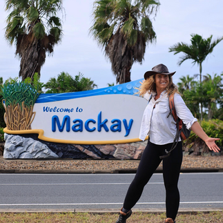
An east coast low saw me held up in Mackay Queensland for a few days until it passed further north and out to sea. I’ve never explored the Mackay region before and until now it was only to pass through heading to the Cape. It’s a busy place where industry meets the tourism sector and with a near-perfect climate, the Mackay region is growing fast.


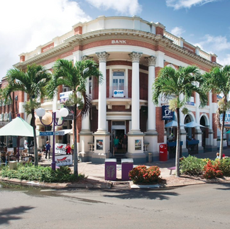

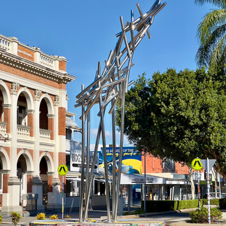
Cook passed by in his 1770 voyage but it was in 1860 that explorer John Mackay reached the Pioneer River with horses and cattle from NSW. The town was established by the river and in 1865 the first sugar cane was planted making the region boom, and over the next 100 years, it has grown to have the largest sugar refinery in the southern hemisphere. The town itself has beautiful buildings dating back to the late 1800’s, it has a busy port and marina area, surrounded by National Parks and they claim to have the longest stretch of sub-tropical rainforest in Australia.


With Mackay behind me, I headed an hour north to Cape Hillsborough National Park where steep mountains meet the sea. Around 30 million years ago lava poured out from a nearby volcanic plug, called Pinnacle Rock. The jaggered battle-scarred rocks can be seen on the drive to Cape Hillsborough where after eons of geological upheaval and weathering it left to what it is today.

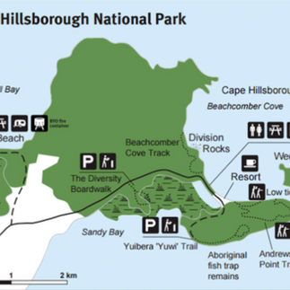


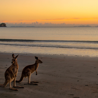
Now this area is a popular destination especially made famous for the Kangaroo’s on the beach at sunrise and the beautiful camping areas. Five hikes from the nature park include a beachcomber walk, the Yuibera plant trail, the diversity track, the Wedge Island hike and up to Andrews Point. Andrews has several lookouts where you can gauge the ruggedness of the volcanic upheaval all those years ago as you walk along the basalt ridge line through old rainforest and eucalyptus pockets.

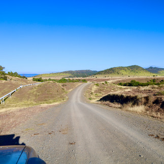
Unfortunately, my visit coincided with coastal showers so the views were very intermittent, and with this, I decided to head inland 100km towards Eungella NP and Finch Hatton Gorge. The Mackay hinterland is a place where thick rainforest pockets give way to deep gorges and stunning waterfalls, which is ever so popular with tourists due to its easy access.

Finch Hatton is one of those places that teams with tourists for most of the year heading up the walking trails to swim in clear mountain waters and to cool off from the humidity. Tucked in the Eungella NP and part of the Clarke Range the landscape is a sculptured masterpiece where dense rainforest is hemmed in by surrounding farms and is regarded as one of Queensland's most ecological and diverse parks. They claim to have over 850 subtropical and tropical plant species, an array of wildlife all protected in its 52,000 hectares.

Today Finch Hatton is the gateway to the gorge and Eungella Np, but it was established in the early 1900’s by cane growers and timber getters. The railway constructed a line into the Pioneer Valley in 1918 to Cattle Creek, but since the closure of the mill, Finch Hatton is now a sleepy tourist town.

Further west up the steep Clarke Range is the sleepy town of Eungella with its historical pub, amazing lookouts, nature walks and rich cultural history. Before white man inhabiting Eungella, two nomadic aboriginal tribes lived in the lush area, they were the Biria and Wiri tribes of the Birri-Gubba people. Eungella is perched high above the head of the Pioneer Valley and is known by the aboriginal people as ‘ the land of the cloud’, probably due to its elevation which is nearly 700m high.


The views at any of the lookouts are simply stunning where you can see the volcanic peaks, plugs, and the rich valley below right out to the Mackay coastline. Throughout Eungella and its cool mountain streams it’s a popular spot where Platypus can be spotted either around the town or out at Broken River which has boardwalks and viewing platforms along the creek.

Eungella NP is full of high peaks and it was in 1878 that white men made expeditions to the 1232m high summit of Mt Dalrymple, not long after the first gold prospectors and red cedar getters arrived in the area. By 1920 the area was thriving and Red Cedar was becoming Australia’s leading export, opening up the Clarke Range where a road was built to the coast allowing the timber to be exported to England.

About 30 minutes to the west is Eungella Dam which was built for town water at Collinsville and Scottsville, plus to meet the requirements for the thermal power station at Collinsville. Run by SunWater QLD, it's open to the public for boating, swimming, fishing and one of the best camping spots I have ever been to.

With all amenities included in the extremely cheap camp fees, there are miles of camp spots right on the water's edge. Just a heads tho, cattle roam around day and night, they are very friendly and not scared to go into a camp looking for food scraps.


With a few days under my belt around the dam, my next destination was a little south of Homevale National Park to explore the gold history. Homevale is full of dramatic cliffs, peaks and volcanic vents that produced gold deposits and fertile soils and now support a diverse plant life.

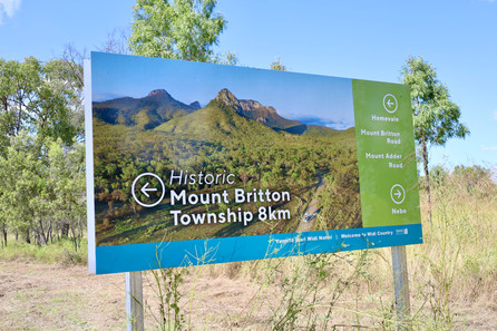
The Nebo Volcano erupted 34 million years ago and is believed to be the second line of volcanoes that erupted down the East Coast at that time. Mount Britton is a good hour's drive away from Eungella Dam and well signposted towards the town of Nebo. Mt Britton was named by explorer William Landsborough in 1856 after a good friend, James Britton.


Alluvial gold was found in Oaky Creek in the early 1880’s, and of course, when word got out the rush was on and within a very short time nearly 1500 people were in the area. Soon there were six hotels, stores, a beekeeper, a school of arts and even a photographic studio. But the gold was short lived and nearly as soon as it was found, it was gone by 1900.

Most people moved on, but one old miner, Anthony Turner, stayed in the area until he passed away in his bed in 1919. Today, a lot of the old mining gear has been relocated where the town used to be. There’s a self-guided walking trail to signage highlighting what was there and its history.

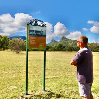


Anthony Turner's corrugated iron hut has fragments of gear, old bottles and written history on the hardships from back in the day plus the 150-year-old fig tree that was planted by John and Mary Ann Mills when their first child was born. The ‘town’ of Mount Britton is surrounded by mountain peaks that include Mt Britton, the Marling Spikes, Boundary Fap Mountain, Mt Adder and Sydney Heads which is the tallest peak at 915 m high.


It’s an interesting area to discover and learn of the hardships that these people faced just trying to make a living and hoping they would be successful one day, but they endured more than what we could ever imagine. Up at the little cemetery, there’s only a handful of graves, some marked and others just a lump in the ground, there was also difficulty in transporting the heavy ore across town to a crusher, but then in 1898 Cyclone Eline caused extensive damage to the area wiping out crops and causing mass destruction.

Following the volcanic mountain peaks from Cape Hillsborough, exploring Finch Hatton and finally up to Mount Britton was one great way to spend a week in the Mackay area discovering so many natural wonders and delving into its amazing history.

WHERE
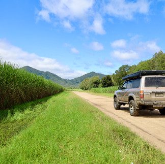
Mackay is just under 1000km north of Brisbane right on the stunning Coral Sea coast where the mountains meet the sea. Volcanic activity millions of years ago created some of the most beautiful and scenic landscapes the East Coast has to offer. Exploring the area can be done in an SUV or lightweight 4WD.


WHAT THERE IS TO DO
There’s a whole lot of activity to do across the week exploring this amazing area. Walking the beaches at Cape Hillsborough, hiking into Finch Hatton Gorge and swimming in fresh crystal clear water, camping at Eungella Dam and wandering the relics of the old gold mining town of Mt Britton. The Mackay area is rich in history with a mix of stunning volcanic scenery to be seen.

OTHER INFO
As usual, most info can be found online at ( https://www.mackay.qld.gov.au/discover-mackay ) or Google search. Camping information at Eungella Dam ( https://www.sunwater.com.au/dams/eungella-dam/ ) and any quick search on socials will bring up a host of beautiful shots on Finch Hatton area and gorge. Mount Britton is 120km west of Mackay with info found on the Isaac council website ( https://www.mackayisaac.com/mount-britton ).


Comentários