THE MOUNT FREELING TRACK. An amazing drive through the Gammon and Flinders Ranges of South Australia.
- Woolgoolgaoffroad
- Mar 6
- 5 min read
I’m always drawn to the Flinders Ranges for its ancient and rugged landscapes, peaceful camping and the impressive geological formations that make up the area, to have the oldest mountain ranges in the world that were formed over 600 million years ago.

At the southern end there’s the majestic and stunning amphitheatre of Wilpena Pound and to the north there’s the drier and more isolated areas of Arkaroola as you head past the Gammon Ranges. The largest mountain ranges in South Australia have a complex series of properties that make up the Flinders, that are almost 430km long and has the second highest mountain in the state.

Getting away from the mainstream tourist trail, I decided to explore the more remote and isolated area of the far north, and in particular the Mount Freeling track eastward towards Arkaroola and Lake Frome. Fueling up at Lyndhurst, I was soon on my way up the Strzelecki Track, which today is far from a track as it used to be, today there’s nearly as much of it sealed as unsealed.

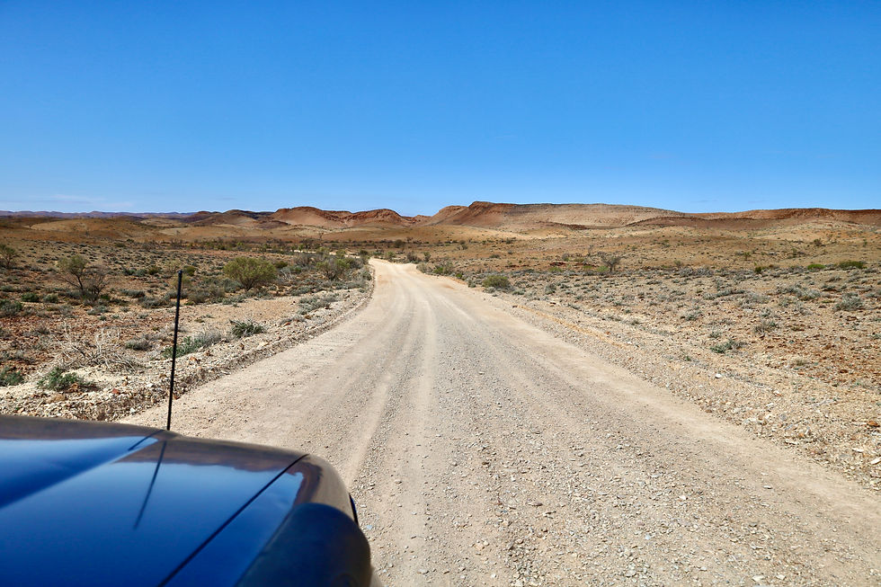
The country is dry and desolate, and about 40km along I passed Mount Lyndhurst station and some old rock ruins near the dry Frome River, passing here it’s another 40km to the Mount Freeling road turnoff to the east.


Mount Freeling station is just 25km up the road and they offer amazing camping, 4WD tracks to explore and plenty of history on the property that date back to 1870. Leaving Mt Freeling, it's just another 20km where I crossed the dry Macdonnell Creek and had my first glimpse of Mt Fitton talc mine.


Although the access tracks are currently closed to the public, the vastness of the talc mine is quite remarkable, having been the site for mining high-grade talc from 1949 until a few years ago.

Passing the talc access tracks, I found the Mount Freeling track turned more into a rough 4WD track with sharp and rough dry creek beds and plenty of ruts until I came across the ruins of Mount Fitton homestead. These ruins date back to 1870, where it was a successful sheep station through the 1920s.

Around the old homestead there’s plenty to see and it's hard to imagine what life was out here nearly 100 years ago. In the distance, you can see the remains of an old copper mine and where they did an explosion test.


It wasn’t long before I left Mount Freeling station and passed through a gate, I was in Moolawatana Station, where my next stop was Hamilton Creek. Now not just a waterhole that often has a number of waterbirds, it's a geological feature of the Flinders and the world.

This is Terrapinna Waterhole that was close to the south pole about 133 million years ago when Australia and Antarctica were near joined. Over a complex number of years and different periods, glacier activity has been found near the waterhole through examinations of the rock layers and sampling.


My destination was still a few hours away at the world-renowned Arkaroola, so at the end of the Talc Mine road it’s a right hand turn to head down Mount Hopeless road for another 95km to Arkaroola’s turn off.
Most people have heard the story of when Sir Douglas Mawson spent time in the Flinders and his then student Reg Sprigg. Over time, the Sprigg family fought to make Arkaroola a wilderness sanctuary for future preservation and eradicate the huge amount of feral animals in the area. Arkaroola today attracts visitors, geologists, hikers and keen 4wders from around the world who want to experience this stunning area.

Basing myself at Arkaroola, I headed out to explore some of their remote 4WD tracks and explore the array of ruins that make this area so famous for. My first stop was the old Bolla Bollana smelter ruins, just 20km to the west. In 1870, a copper smelter operated here that was to service the small copper mines that were scattered across this harsh landscape. Info boards around the site explain the history, the hardships and workings of the smelters that only operated for a short time.


Leaving the smelters, I headed along the four mile creek track and towards the Old Illinawortina stone ruins and Idninha outstation. Wandering around Illinawortina, it's hard to imagine life out here, isolated from mainstream and working in all conditions. The stone work that still stands is incredible, and it's only crumbling due to its age, as well as the main house, there’s an underground cellar.

At Idninha, the outstation is in better condition and nowhere as old, with a new roof and closed off entry points, the preservation should last another 100 years. From Idninha I headed towards the Wurtupa Loop road where there’s plenty of old bore tanks, windmill ruins and remote camping areas to be found.

Midway along the track, Grindells Hut can be hired out as an accommodation option to explore this section of the Gammon ranges. Grindells has a grizzly past where his daughter married a nearby property owner, Mr Snell, to whom he didn’t approve. During a muster, Snell didn’t return home and his body was found burnt next to a campfire. Fingers pointed towards Grindell and he was arrested for murder and sentenced to death, after much protesting by his family, he was sentenced to hard labour and released 10 years later. I allowed two good days to find the ruins, explore the area and take in the whole area, the tracks are 4WD only, slow and rough.

My next port of call was Balcanoona, which was once a thriving pastoral lease from 1856 until 1980, where it was purchased by the SA government, and it was proclaimed as part of the Gammon Ranges NP. Around Balcanoona there’s self-guided walks, info boards, buildings and relics to explore, there’s also camping, where travellers can grab a shower and top up with water.


To the east, 35km away and along the Lake Track, Lake Frome is a stunning and unusual endorheic lake to visit. This vast inland shallow lake rarely fills, and when it does it retains all the water and doesn’t flow out. The local Adnyamathanha people named the lake Munda but Europeans named it after Edward Frome who mapped the area in 1843.


The Flinders and Gammon Ranges are a vast area with a huge amount of European and Aboriginal history, stunning scenery, a host of walking and 4WD tracks, throw in old ruins and gorges plus some of the best camping and station stays that SA has to offer. The Flinders need to be visited at least once in your life to understand the sheer vastness and beauty of the area.


WHERE
The Mount Freeling track heads off the Strzelecki track about 85km out of Lyndhurst in remote South Australia. Isolated and rough station track leads you through the beautiful northern part of the Flinders Ranges. This is a very remote country where you probably won’t see another vehicle across the whole track. Ending at Arkaroola there’s plenty of out-station ruins, more remote 4wd tracks to explore plus viewing the stunning colours that the Flinders is known for.


WHAT TO SEE AND DO
Explore ancient old gorges with your 4WD, camp in remote places and stargaze, find the many old station ruins and cast your mind back to how hard it would have been, walk around old mine sites or take a tour from Arkaroola, there’s plenty to keep you busy for days. Mount Freeling offers camping plus their station stay in the old shearers quarters, plus across at Arkaroola they have some of the best camping in the northern Flinders where you can base yourself for several days to truly explore.


ESSENTIALS
A well-kitted out 4WD is extremely essential, plus you need to be comfortable with remote travel. There’s no fuel for several hundred km between Lyndhurst and Arkaroola and no phone signal. The trip can easily be done in one day, but allow several days exploring the many tracks and features around Arkaroola, the drive to Lake Frome and the northern Flinders.


Comentários