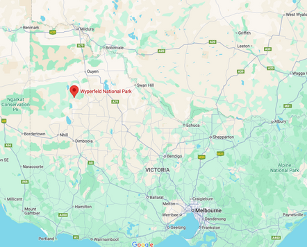
WYPERFELD NP........Victoria.
- Woolgoolgaoffroad
- Mar 27
- 6 min read
Having just finished the iconic Border Track that marks the boundary between Victoria and South Australia, I noticed a turnoff to Wyperfeld NP. Being someone who never misses an adventure, I quickly found myself entering the park.

Wyperfeld is the third largest NP in Victoria broken up into three different management areas to protect its fragile Mallee country, indigenous heritage and European history. Covering a staggering 357,000 hectares it was first reserved in 1909 but declared in 1921 to protect and manage. The Wotjobaluk people have called Wyperfeld home for many generations and there are signs throughout the park where artefacts, middens and burial sites have been found and are now protected.


Broken into three different areas, Wyperfeld had a very special feel while exploring the various areas. To the west, there's the Big Desert Wilderness area that's only accessible to experienced hikers. Just over 145,000 hectares between the Border track and the Murrayville Track, it's one of the least disturbed areas in Victoria with a protection order over it.

To the north, a pocket of land called State Forest has a maze of sandy 4WD tracks and camping areas to explore. Through this area, three main dedicated 4WD routes allow you to explore different areas with various POIs along the way. From stands of red gums, pines, and casuarinas to low heathland vegetation and even steep dunes where the sand can be softer than a beach drive. The hardest track through this section of the park is the Milmed Rock Track which covers 175km through some of the softest and steepest sand I’ve ever encountered. It’s a good 7-hour drive on the loop, there are two separate campgrounds along the way, some old water springs and the Milmed Rock formation.

The Nhill-Murrayville Track cuts between the Wilderness area and Wyperfeld Np for its entire length of nearly 80km. Classed as a 4WD track, today it’s just a big well-maintained dirt road when it's dry, but, signs say when it's wet it gets very slippery and 4WD only. This track was put through back in 1860 when cattlemen walked stock between Nhill Station and Kow Plains Station and was only suitable for wagons until it was upgraded in 1936.


Along the way, bores were sunk with windmills and tanks built for passing stock. Today many of these can be found and there are three major campgrounds along the way - Big Billy, Stockmans Camp and Broken Bucket all have significant history surrounding them. Big Billy was established in the 1800s for the stockman and today it's a popular camp spot with toilets and a shelter with heaps of info plus there’s a short walk to a viewing point across the stunning Mallee country, a great place for that afternoon drink as the sun goes down.


For many years European settlers stayed away from the area because of the sandy infertile soils and low rainfall, this gave way for the native animals and plants to thrive as the land wasn’t cleared. There's an estimated 200 bird species that have been spotted in the park along with a large selection of reptiles, surprisingly snakes are rarely seen in the park.

Wyperfeld is known for its dunes, with nearby areas called The Big and Little Deserts, records date the dunes to be around 40,000 years old after the shallow sea retreated from the area over 25 million years ago. As the seas disappeared the westerly winds blew the sand across the inland areas creating what’s left today. There are lakes through and around Wyperfeld that are connected by Outlet Creek eventually spilling into Lake Hindmarsh to the south which is Victoria's largest inland freshwater lake. When the rains come the park transforms the semi-arid landscape into mats of colour as the dormant seeds have been waiting patiently.


The eastern section of Wyperfeld has more heath lowland where shallow lakes are dry for many years and lined with huge red gums, native wattles, casuarinas and cypress pines. The Snowdrift Camping Area in my eyes was the best in the park with its huge camping areas, fire pits and toilets, but the backdrop with a massive dune was a beautiful feature.

Climbing the soft sand was an effort but the views at the top were to die for across all areas of the park. Sunrises with the low fog gave an eerie feeling to the start of the day and the stunning sunset was magical as the last rays shone across the park.


An hour to the south of Snowdrift, the more formal camp area of Wonga is 2WD accessible from the south, but also a great base to set out from in a 4WD. Wonga has several walking trails for those inclined, a 15km circuit drive around Lake Brimin with signs revealing insides into the Mallee treasures along the way. Named after Sir James Garret for being an outstanding advocate for the extension and creation of Wyperfeld NP.

In 1855 the original Pine Plains Station covered 45,000 acres and 7 years later the station split into two different sections. Wonga Lake Station occupied the southern area and today a replica hut was built in 1934 for visitors to shelter in bad weather. Today it’s a piece of history with items and signage highlighting the days gone by. Across the paddock, Parks Victoria has built a huge information centre where visitors can wield away time reading and viewing cultural, pastoral and other important history relevant to the park and local area.


Outside, an old lake Whim has been restored, the original was built in 1865 where a horse was harnessed to one side and as it walked in a circular path it drew a bucket up from the well full of water.

From Wonga, The Freeway 4WD heads out towards the outer reaches of the park is only suitable for high clearance 4WDs and def no towing through the soft sand, Parks recommend you monitor UHF channel 16 if travelling this road and if help is needed.

Along the way, old Rabbiters Camps have been restored that were established when a rabbit plague hit the area in 1873, many people made a living from culling these feral pests instead of grazing sheep. Numerous huts were scattered across the Mallee landscape and today with the help of different organisations this one has been preserved along with memorabilia that line the inside of the tin hut.


Wyperfeld took me by surprise when I thought it would be ‘just another park’, but exploring its history, amazing Mallee country, driving sand tracks that I thought were only in the desert and some of the best campsites I’ve seen for ages, I am suitably impressed. I will be back.


About Wyperfeld NP.
Wyperfeld NP is a very unique area it blends in with a Wilderness Park, and State Forest, covers a huge Mallee area and where old stock routes traversed through. Sitting on the VIC-SA border in the northwestern corner of Victoria, Wyperfeld covers 357,000 hectares of protected semi-arid Mallee country, 450km NW of Melbourne. The third largest NP in Victoria it's known for its birdlife like the remarkable mound-building malleefowl.


What to see and do.
Wyperfeld is secluded with 4WD tracks, and remote walking trails for the naturalist, there’s plenty of camping areas and the opportunity to spot the array of birdlife and visit wildflowers after good rains. History dates back to the mid 1880’s when stock was walked through the park and where bores were sunk. Old stock camps and challenging 4WD tracks are an attraction to the park. There are a multitude of beautiful remote camping spots with different aspects. Snowdrift is below a massive sand blow with stunning views from the top, then there’s Big Billy in the heart of Wyperfeld, plus remote simple camp areas across to Stockman camp and Broken Bucket which are old watering sites for passing livestock.


Other information.
Murrayville, 33km to the north and Horsham 110km to the south, are the two closest towns for supplies. There are signs with comprehensive park information and maps at the park's entry, but by downloading the ‘More to Explore’ app by the Victorian Government, it will allow you to use interactive maps with relevant info as you explore the parks. Summers can be extremely hot and dry with the risk of fires and the winters are very cold. Midspring and Autumn are the best time to visit.


Comments